

Posts with tag 'Central Oregon Hikes'
Subscribe and receive email notifications of new blog posts.
 RSS Feed
12
Hidden Treasures in the Three Sisters Wilderness in the Central Oregon Cascades
Leave the Path to Find Little Seen Tarn Lakes Above Green Lakes
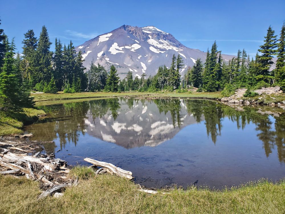
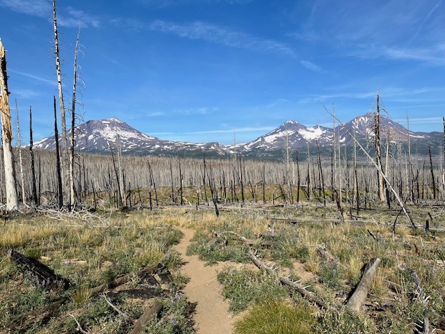
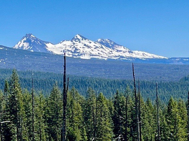
There are hidden treasures in the Three Sisters Wilderness which can be found for those willing to leave the path and follow a compass or GPS to locate them. In particular, there are several beautiful tarn lakes located roughly a half mile off the Green Lakes trail which connects the Green Lakes valley with Park Meadow over the pass between South Sister and Broken Top. There is no path to these lakes, but people good with following a downloaded map can find them. The first four lakes can mirror views of South Sister and their general location can provide views toward Golden Lake as well.
 |
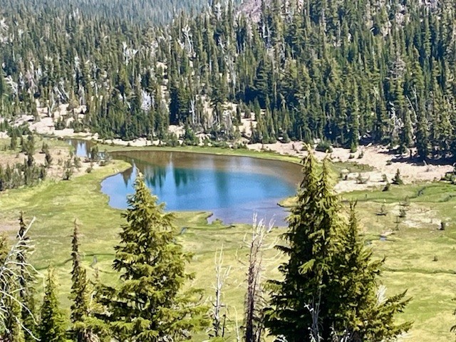 |
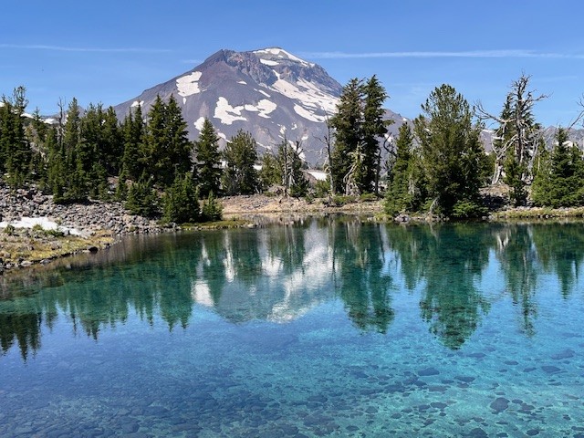
Past the four lakes walking toward Broken Top, hikers can follow a general topography line on a map and find the other two tarn lakes located just below Broken Top. These two lakes can more easily be accessed by following the path next to the creek which flows into Golden Lake. Both of these tarn lakes are located in a cirque bordered by a moraine. On the lower lake, the beautiful blue water was flowing over the top of the moraine forming a waterfall flowing into the creek below in early August 2025. At other times, the water which flows into the creek comes out of a spring at the base of the moraine. At the upper lake, sometimes the voices of people on the top of the ridge overlooking Broken Top's No Name Lake can be heard, although they are not seen due to obstruction from topography and vegetation.
 |
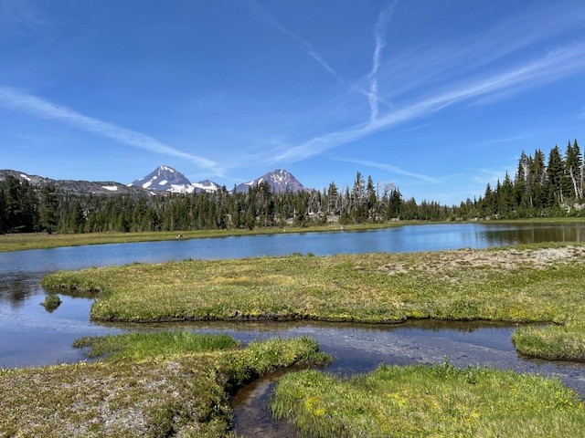 |
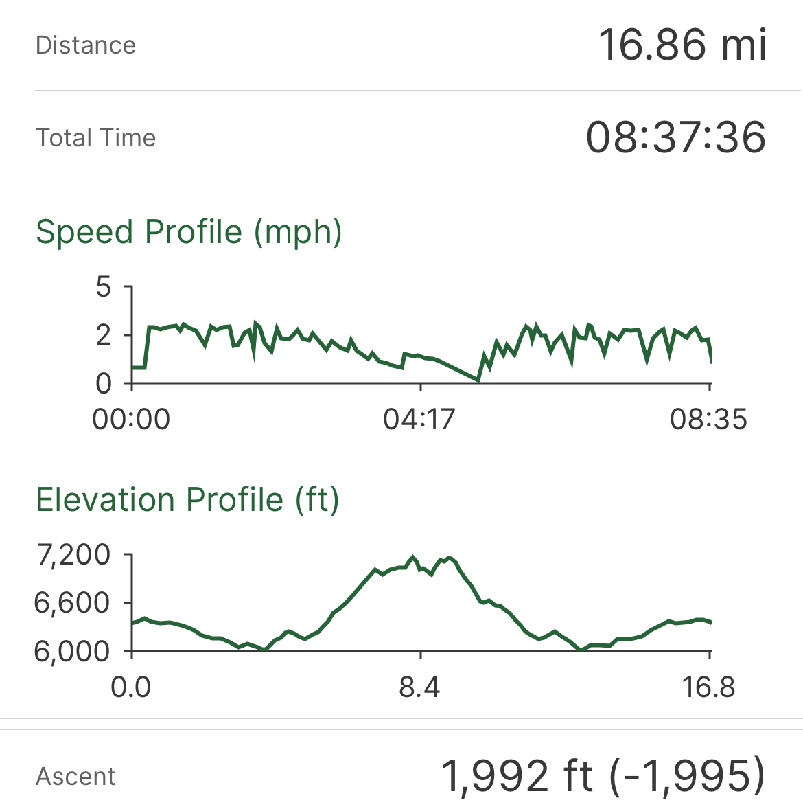
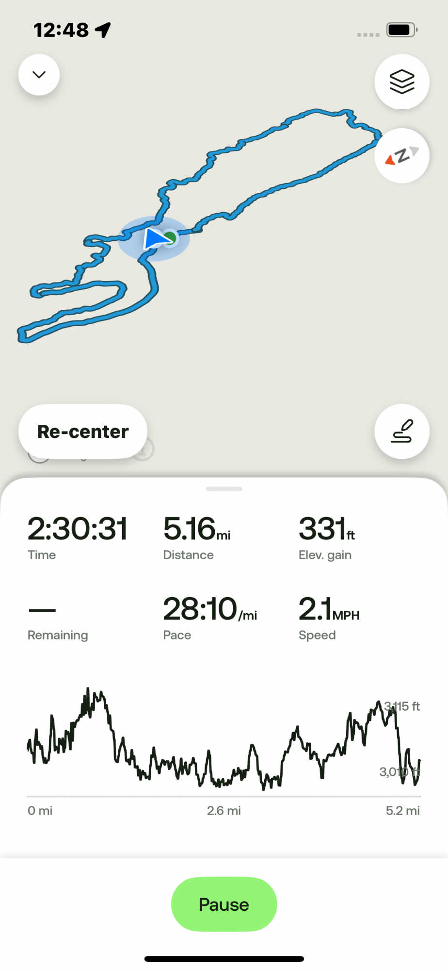
The more direct route back to the trail is following the path down the creek to Golden Lake and from there, rejoining the Green Lakes Trail. Hikers can either return to Green Lakes over the pass or travel northeast to Park Meadow and from there to the Park Meadow trail head near Three Creeks. This second option will involve hiking through over 4.5 miles of burned forest, however. Both methods can be done in a long day, those coming from Green Lakes hiking over 18 miles and those coming from Park Meadow close to 17 miles. Others could pack in camping supplies and better explore and enjoy the day in the area.
 |
 |
11
Bend Premier Real Estate | August 2025 Newsletter
What's in the August 2025 Bend Premier Newsletter?
- It is Taking Longer to Sell Bend Homes
- Gyro Smash Tacos
- Selling in Summer Versus Fall: What Changes and What Doesn't
- The Wildflowers Are Blooming at Canyon Meadow at Three Fingered Jack
- Home Price Forecasts for the Second Half of 2025
7
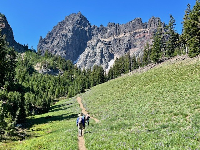
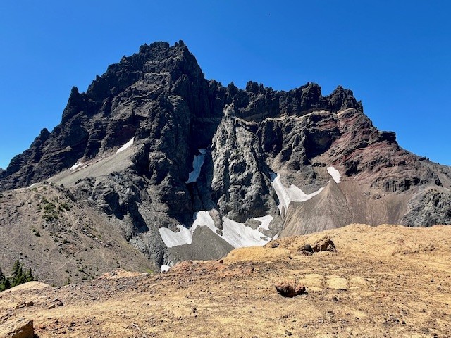
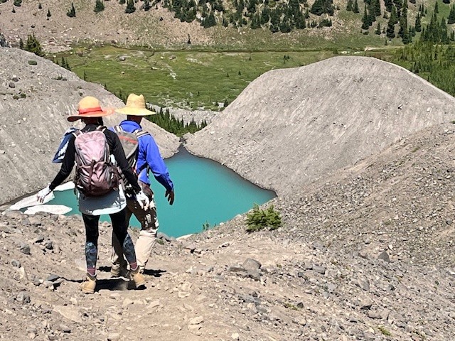
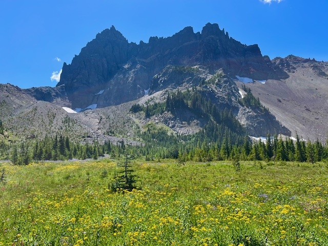
Canyon Meadow and Three Fingered Jack are Wonderful Summer Central Oregon Hikes
The Wildflowers are Abundant in Central Oregon's Canyon Meadow in the Mt. Jefferson Wilderness
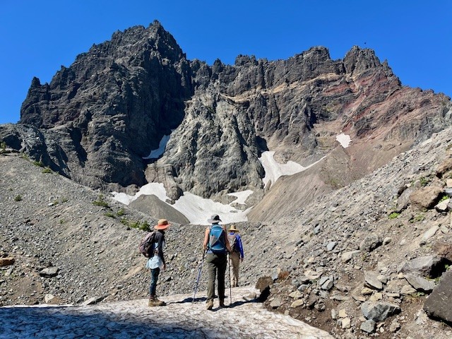
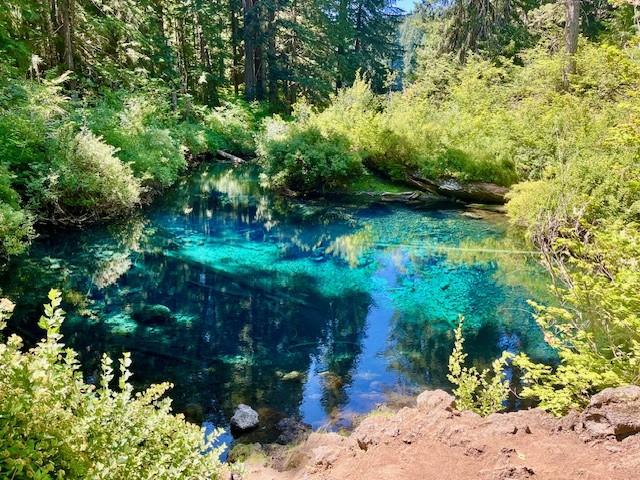
The heavy snow experienced during the winter of 2024-2025 delayed the opening of the most popular Central Oregon hikes until later in the summer. However, the heavy snow also provided extra moisture in the soil which has resulted in a fabulous wildflower season. Among the best areas for wildflowers in the Central Oregon Cascades is Canyon Meadow, part of the hike to the base of Three Fingered Jack. Canyon Meadow hike is a moderate loop that takes hikers from Jack Lake to the meadow and then returns through the burned forest resulting from 2003's B & B complex fire. However, for those wanting a more challenging hike, taking the unmaintained spur from Canyon Meadow to Three Fingered Jack provides for spectacular views and a tough scramble up the moraine of Jack Glacier (unofficial name) which is mostly gone. The aqua blue of the glacial lake was especially stunning the beginning of August. Hikers can climb the moraine until they reach the ridge connecting Three Fingered Jack with the unnamed colorful hoodoo next to it. The flat top of the ridge can be a great location for lunch or a snack before taking the slow trek down the moraine back to the more established trail. There is a side trail that can be taken to the upper meadows following the stream which exits the moraine. The upper meadow was stunning with blooming wildflowers the beginning of August. Once the lower meadow is reached, the loop back to Jack Lake can be taken, although much of this is in burned forest. Another option is to return the way hikers arrived at Canyon Meadow rather than continuing the loop through the burned forest. This will add elevation and distance, however.
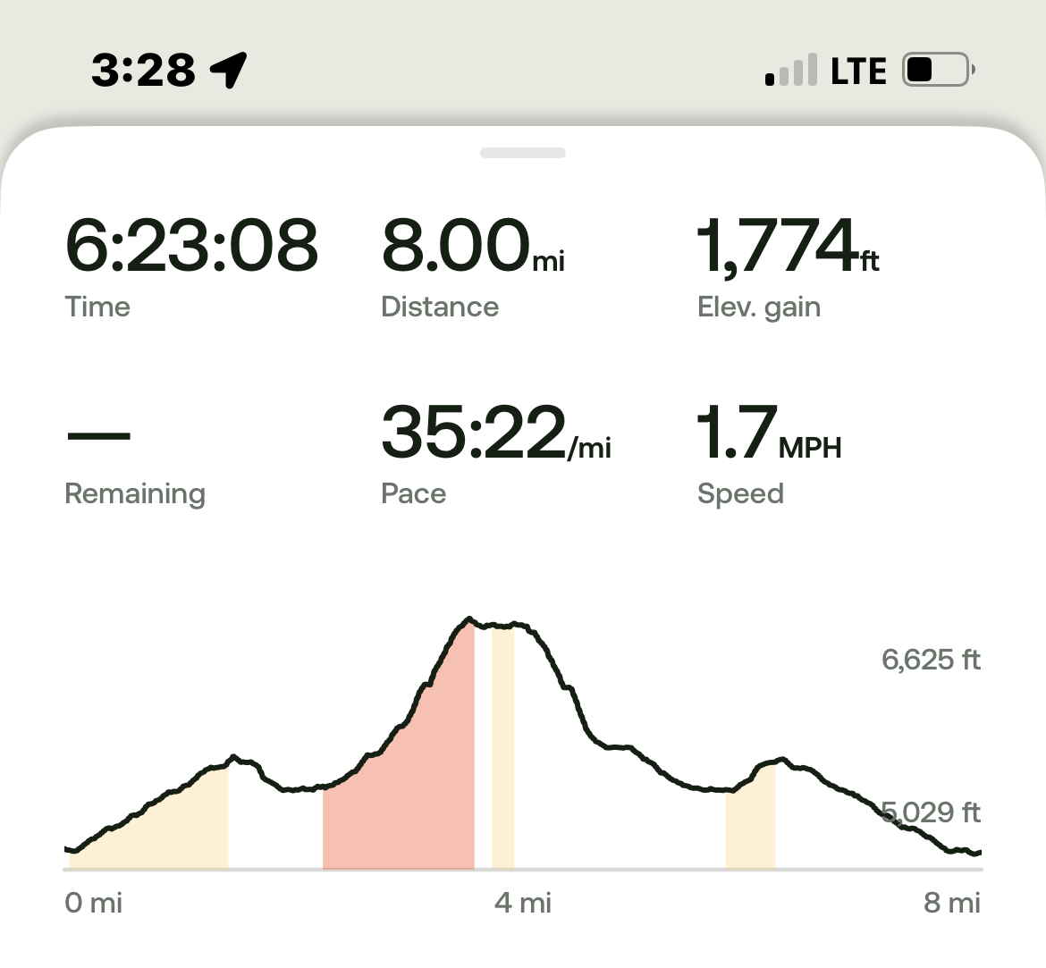
All in all, for those not taking the loop but returning the way to Jack Lake that they arrived at Canyon Meadow, the entire hike is roughly 8 miles and just shy of 1800 feet of elevation gain.
 |
 |
 |
 |
 |
 |
24
Clear Lake is an Easy Summer Hike
For those looking for an easy summer hike in the Cascades, it is hard to beat Clear Lake. Better known as a great hike for fall color, it can be enjoyable to spend a few hours hiking the five plus mile loop around Clear Lake in the summer. It is during the warm summer months that many families drive to Clear Lake to enjoy the beautiful water with their rowboat, kayak, paddle board or other floating device; motorized vehicles are not permitted on the lake. While hiking the easy path, it can be fun to watch the young families fishing or paddling around the lake and enjoying the food at the resort. There are year-round cabin rentals available as well as camping. Run by the Linn County Parks & Recreation, the resort is located in the Willamette National Forest and the lake contains the headwaters of the McKenzie River via a percolating spring at the far end of the lake. The lake was formed 3000 years ago when lava from Sand Mountain backed up the river forming the lake. The remnants of the flooded forest are still visible 120 feet underwater and have not fully rotted in all the centuries due to the extreme chill of the lake.
 |
 |
 |
 |
30
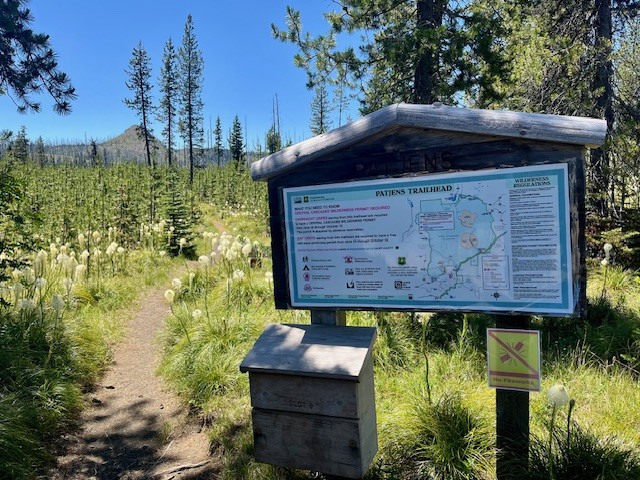
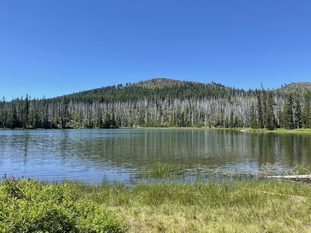
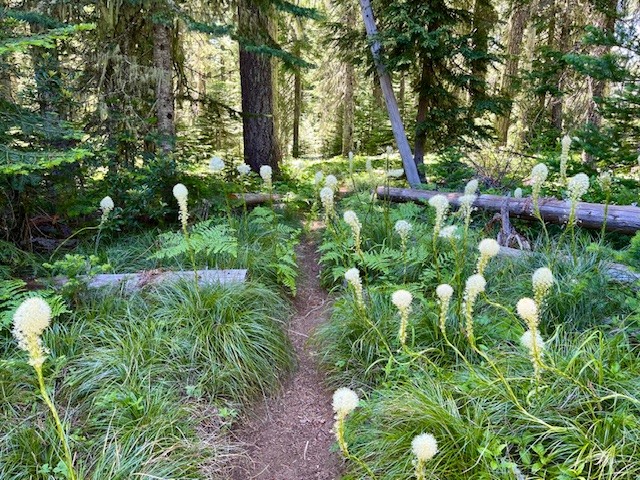
The Bear Grass is Blooming at Patjens Lakes Loop Trail
Patjens Lakes Loop Trail is a Moderate Hike in the Mt. Washington Wilderness
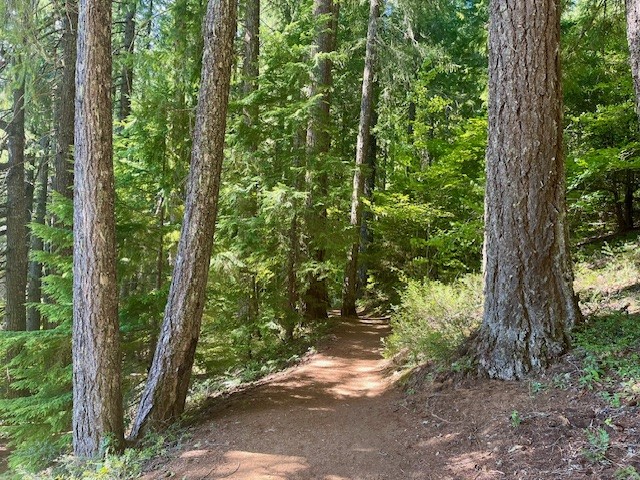
For those who are looking for a Bear grass hike in Central Oregon, Patjens Lakes Loop Trail is hard to beat the end of June 2025. When hikers leave Hwy 20 to drive to the paved trailhead near the end of Big Lake Road, blooming Bear grass can be seen on each side of the road, a great indicator that the hike has a significant amount of it seen during the trek. Patjens Lakes Loop Trail runs adjacent to Big Lake at Santiam Pass before it leaves the lake to run south into the Mt. Washington Wilderness where it skirts the 4 small Patjens Lakes before returning to the starting point next to Big Lake. There are still signs of the B & B complex fire of 2003 which burned over 90,000 acres in the Mt Washington and Mt Jefferson Wildernesses, running along the crest of the Cascades. However devastating the fire was to the area, the burned areas provided more growing areas to sun-loving plants, such as Bear grass.
 |
 |
 |
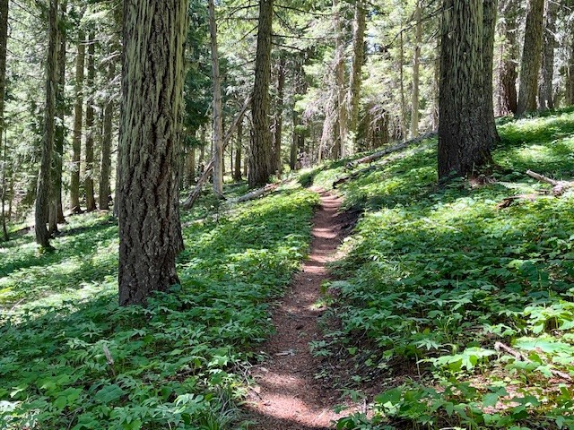 |
Areas untouched by the fire retain the lush undergrowth and tall trees of most Western Oregon old growth forests, complete with shade-loving plants and many birds. The last two miles of the hike, however, are in the burned area. Part of the path climbs a ridge from which hikers have amazing views of the Three Sisters, Black Crater, Hoodoo Ski Area, Three Fingered Jack and Mt. Washington. The slope of this ridge is covered with Bear grass and the Cascade views would not be evident had the area remained unburned.
The entire hike is under 7 miles with a little over 700 feet of elevation gain, considered by many a moderate route.
 |
 |


Privacy Policy / DMCA Notice / ADA Accessibility