

Posts with tag 'Why We Love Central Oregon'
Subscribe and receive email notifications of new blog posts.
 RSS Feed
7
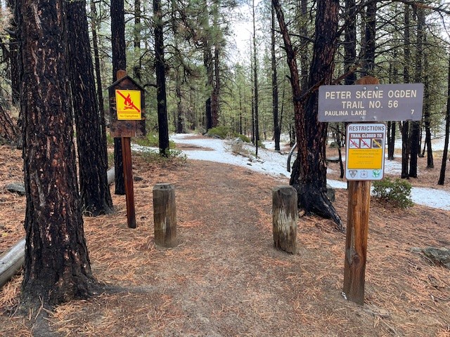
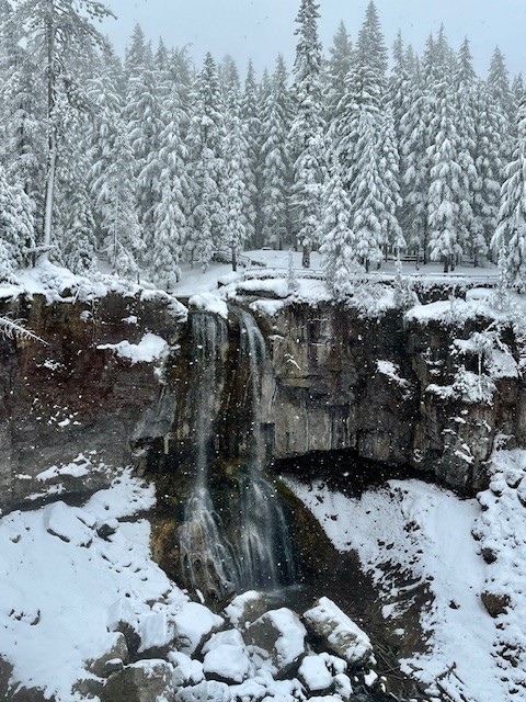
Hike to Paulina Falls in Winter for a Truly Unique Experience
Hike to Paulina Falls in the Winter for a Unique Experience
Once the roads into the high Cascades have been closed for the winter, there are more limited hiking opportunities for Central Oregonians. However, one favorite hike is close to La Pine state park and on the road to Newberry Crater. This is the Peter Skene Ogden trail which follows Paulina Creek all the way to Paulina Lake. Hikers can take the trail as far as they wish, although during winters with heavy snow, it can be challenging and snow shoes would be recommended.
November 2, 2024 was scheduled to be cloudy, but dry. The lower elevations of Peter Skene Ogden Trail had patchy snow, but it was easy walking.
 |
|
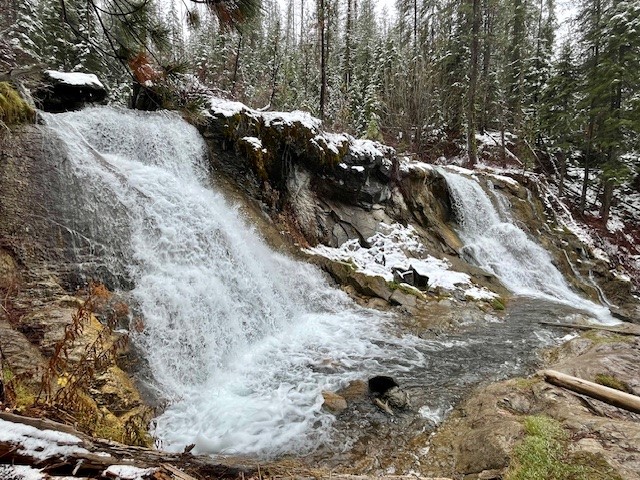
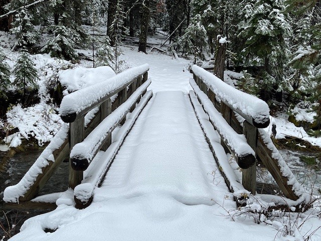
Two and a quarter miles into the hike, the second large, "twin" waterfall is passed and then the hike steepens until the bridge is reached which crosses over Paulina Creek. Past the bridge the snow deepened and hikers without snowshoes had to post hole in soft snow to get any further.
 |
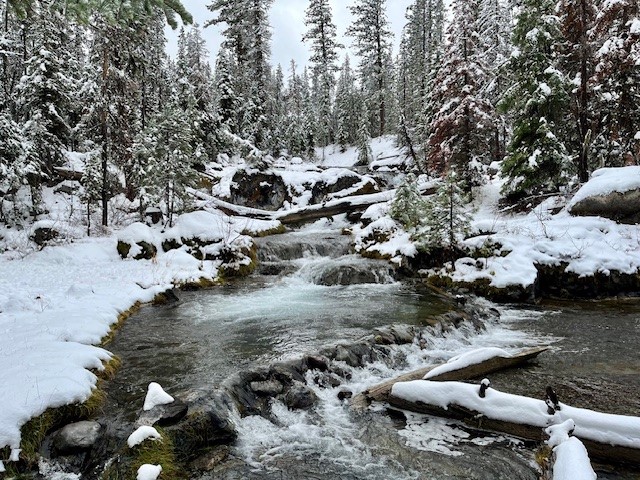 |
The path also steepens past the bridge and there was more accumulated snow. Central Oregon typically doesn't get a lot of snow early November, but 2024 was different with the snow depth on Peter Skene Ogden Trail over a foot at Paulina Falls. With more snow falling and the trees covered in a snow blanket, it was truly a winter wonderland with no other hikers seen. The entire hike up and back was just under twelve miles and over 1500 feet of elevation gain.
 |
30
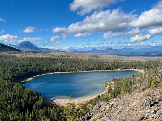
Hiking Tam McArthur Rim to No Name Lake in Fall is an Experience
Cascade Mountain Hikes in Fall Can Have Unexpected Weather Conditions
Hiking in the Oregon Cascades in the fall can offer amazing experiences with stunning views, early snow, fall colors, and no need for forest passes. However, the weather can also change suddenly and hikers need to be prepared.
On October 26, 2024, the hike from Three Creeks Lake to Tam McArthur Rim began with low clouds covering the Cascades. The hike up from the trailhead (the sign was already covered for winter), to the rim experienced some wind, although much of the early part of the trail was in sheltered forest. Once reaching the rim, the winds really picked up, but the clouds also lifted so that the mountains (Broken Top, The Three Sisters, Mt Washington, Three Fingered Jack) could be seen.
 |
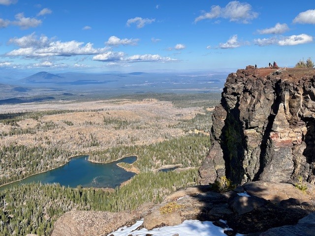 |
Typically the unmaintained trail from Tam McArthur Rim to Broken Top and No Name Lake is fairly simple until hikers reach the cinder rim which is traversed before getting to Broken Hand. On October 26, the clouds lifted and the wind picked up. For those not prepared for wind chill, the gusty winds would have really impacted comfort. Hiking below Broken Hand rather than across the face made a lot of sense as the wind was getting even more fierce. Upon reaching the ridge overlooking No Name Lake, the wind was extremely strong and it was difficult to even stand; anything loose would have been blown off the ridge. Getting a few pictures and returning to a more sheltered space behind a rock outcropping made sense, as well as drinking hot drinks before attempting the trek back. Very few people traveled this hike to Broken Top this day, although upon returning to Tam McArthur Rim, there were a good number who had reached the rim in the afternoon once the weather warmed a bit.
Anyone who hikes in the Cascades in the fall needs to be prepared for changing weather and unexpected situations. But for those who do, the rewards can be amazing.
 |
 |
9
Bend Premier Real Estate | October 2024 Newsletter
What's in the October 2024 Bend Premier Real Estate Newsletter?
- Bend Home Sales Are Up
- Easy Cheeseburger Soup
- Fall Activities in Central Oregon
- Canyon Meadow Hike
- The Top Three Reasons Affordability is Improving
4
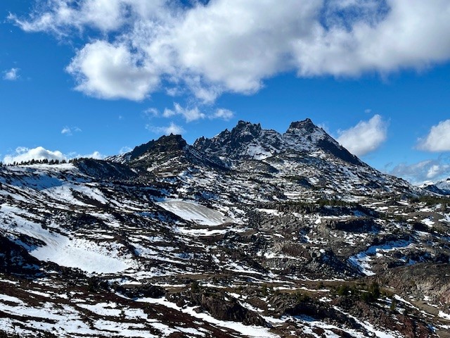
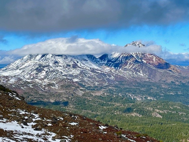
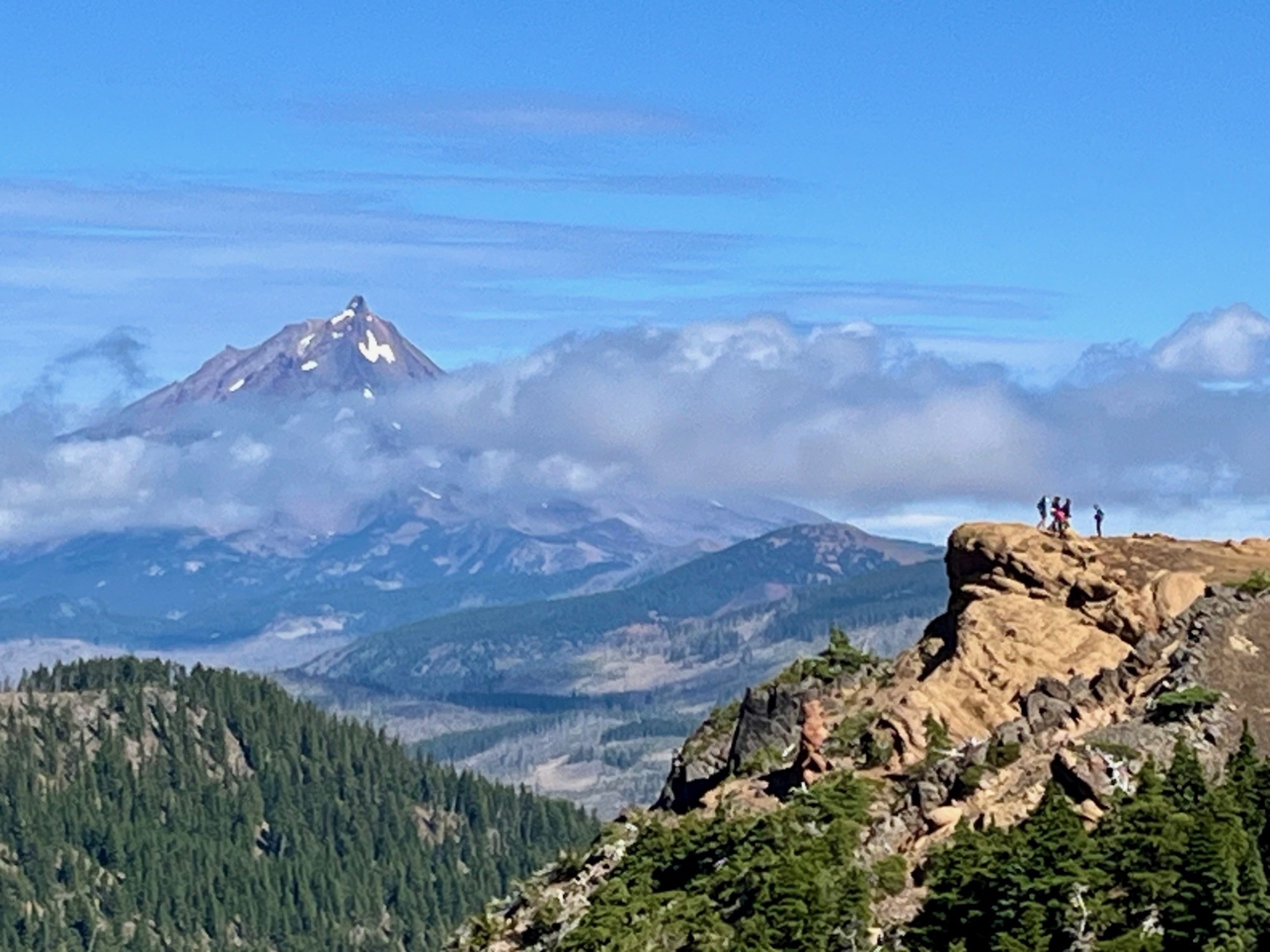
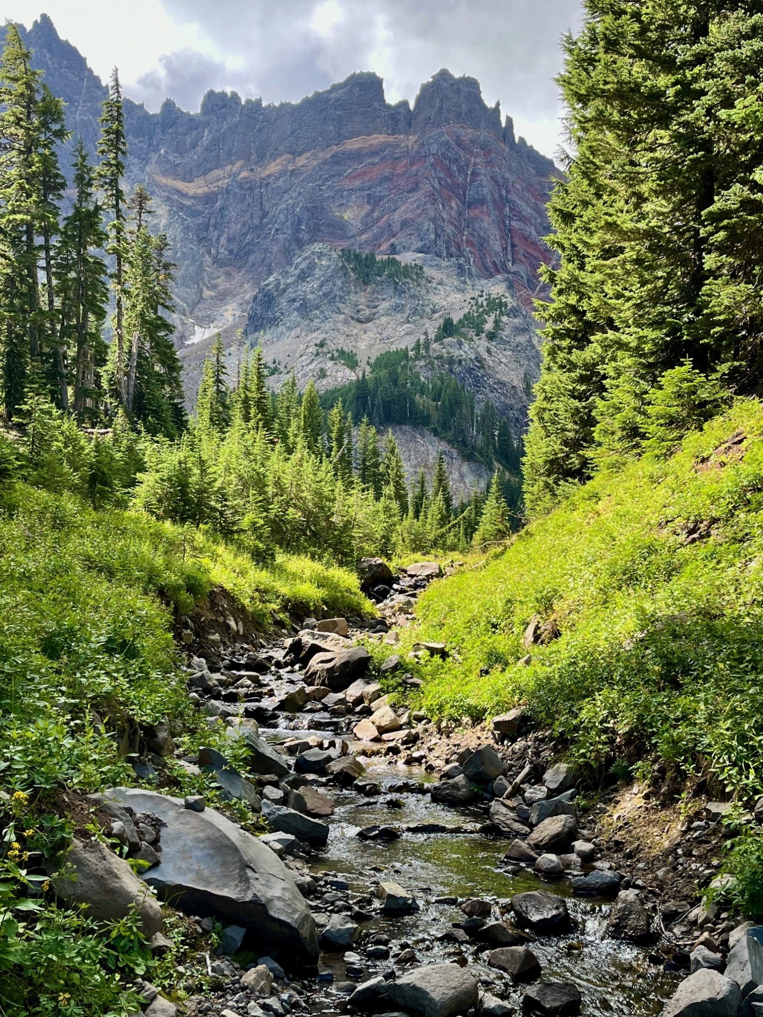
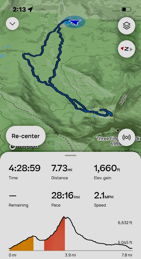
Canyon Meadow Hike is a Great Way to Explore Three Fingered Jack
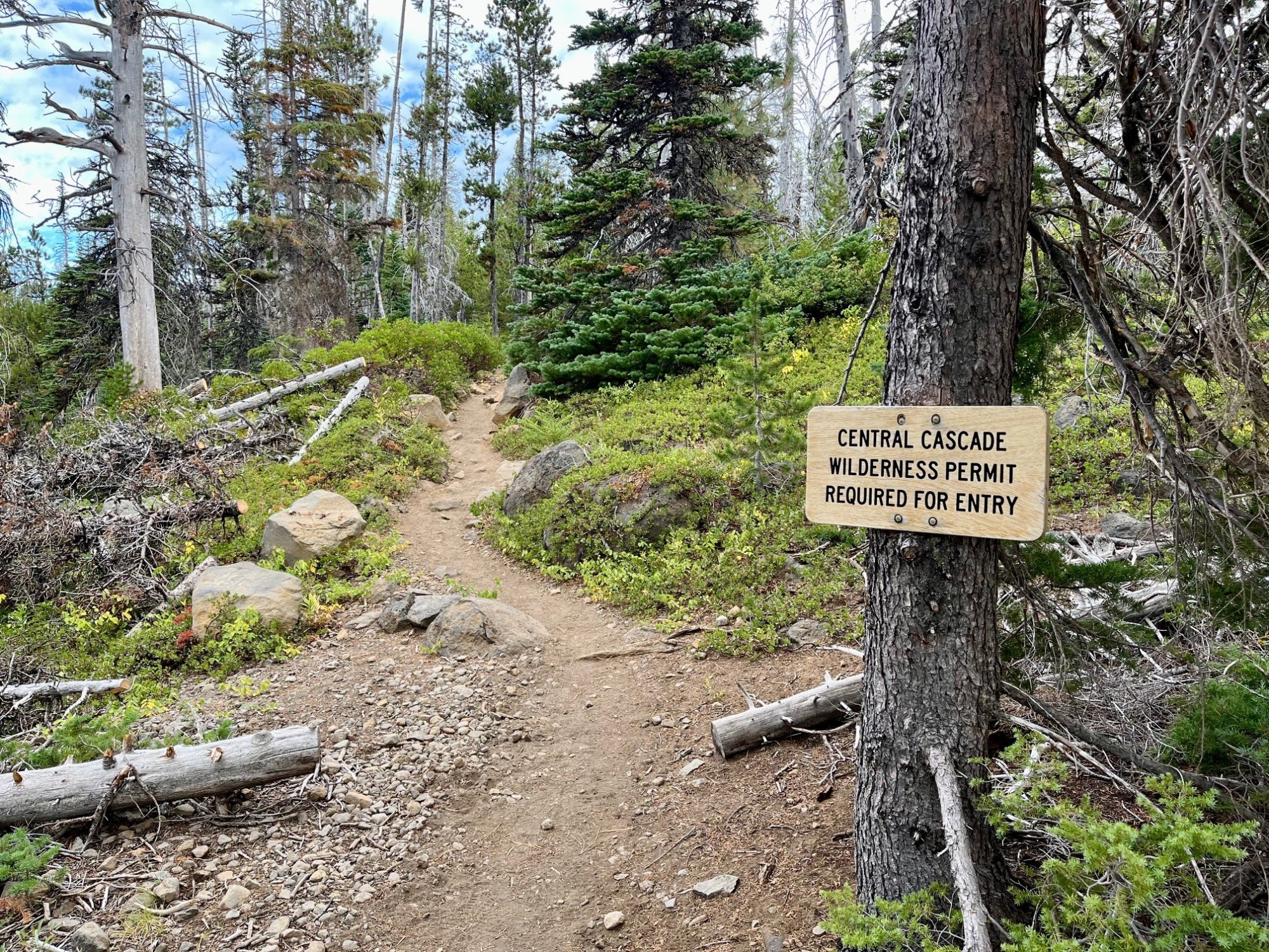
Canyon Meadow is a Permitted Hike in the Mt Jefferson Wilderness
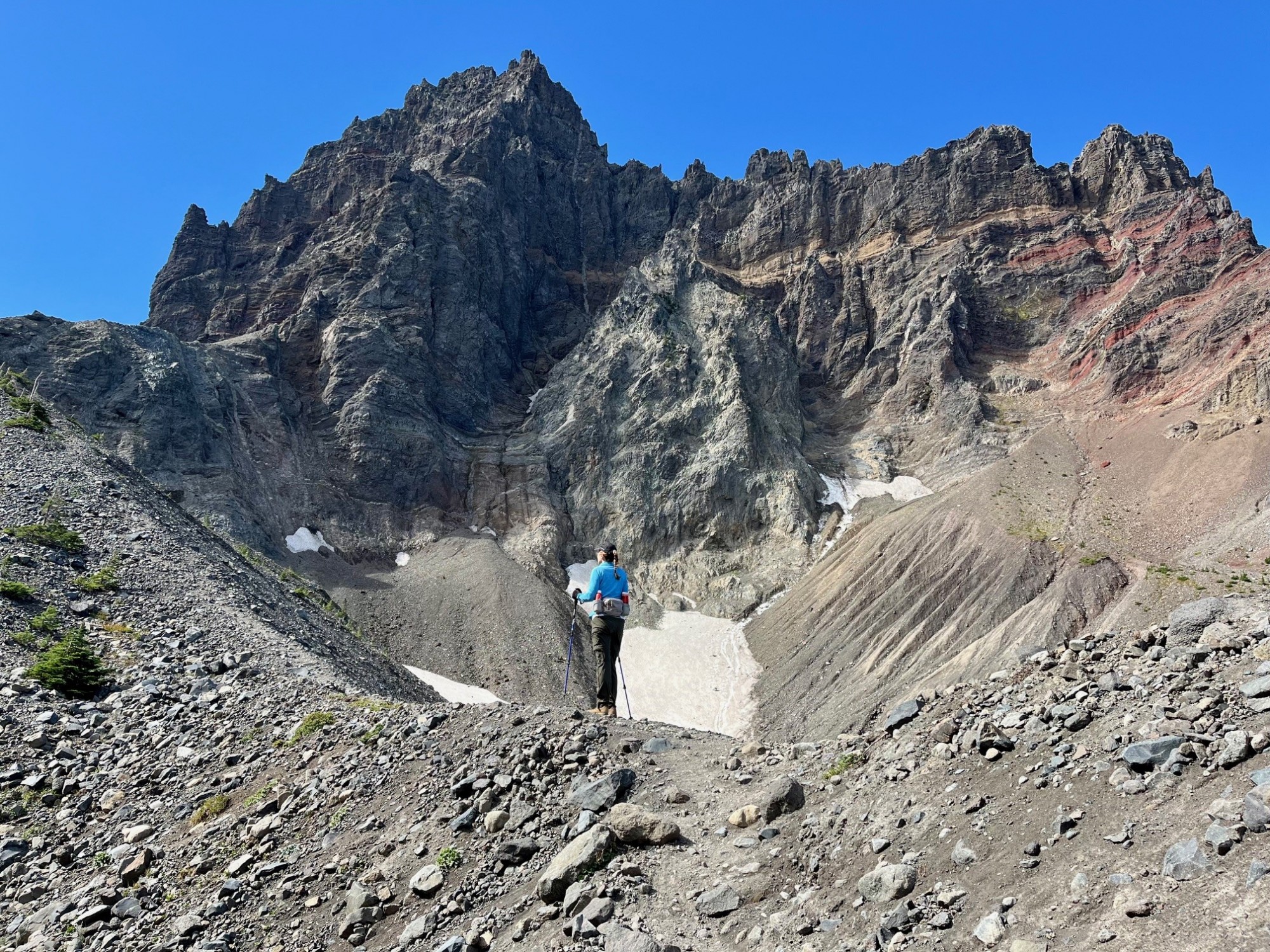
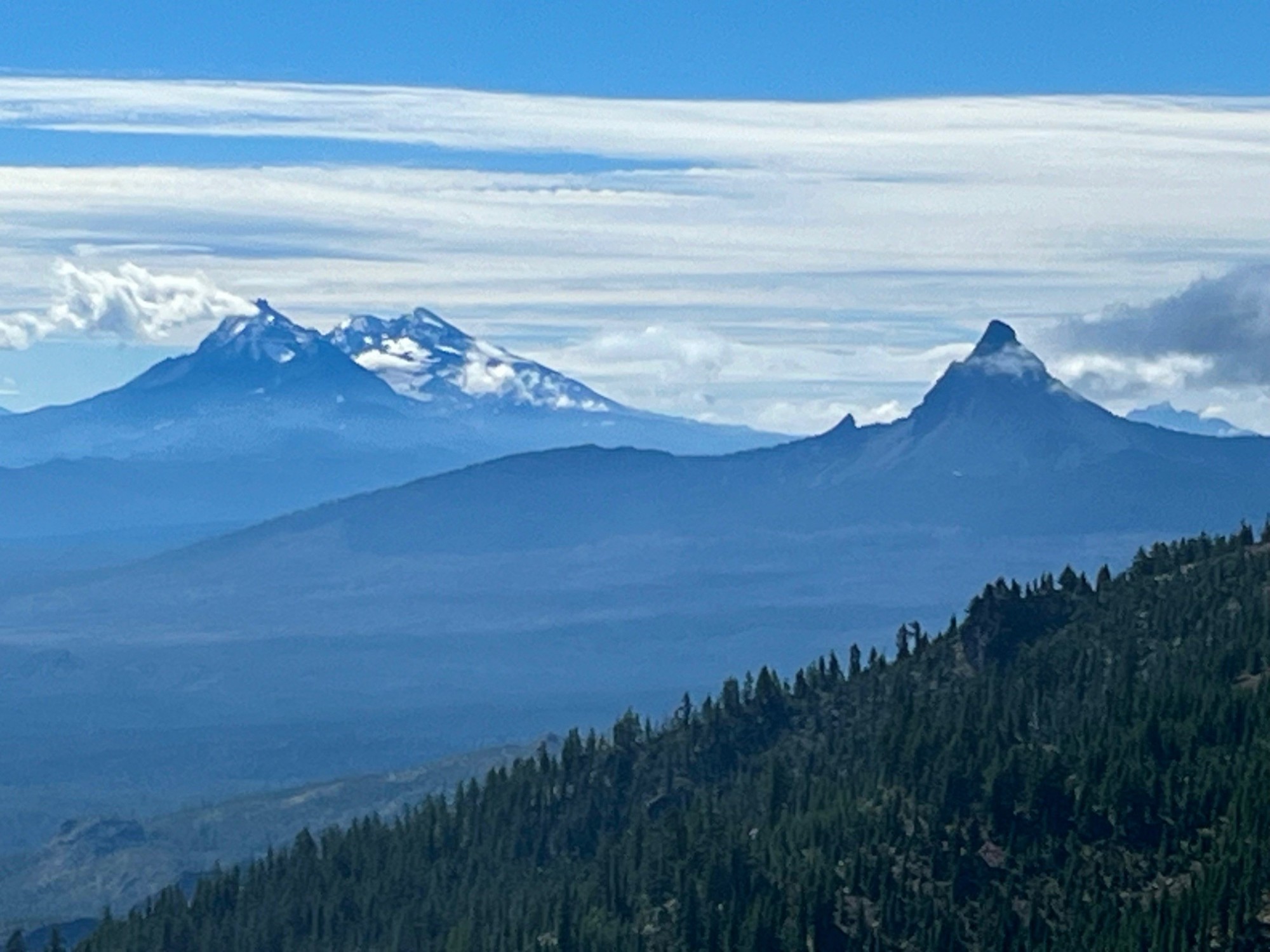
Canyon Meadow is a relatively easy hike in Central Oregon if limited to just the meadow loop which takes trekkers through burned forest, old growth forest and the meadow back to the beginning at Jack Lake. However, many will take the one way climb past the meadow up to the base of Three Fingered Jack. This adds significant elevation gain as well as beautiful views of Three Fingered Jack, sometimes including mountain goats and technical climbers on the craggy top of the mountain. For those adventurous enough to climb the loose rock and pumice past the glacial lake onto the ridge separating Three Fingered Jack from the nearby unnamed hill, the views south toward the Three Sisters and Mt. Washington and the views north toward Mt. Jefferson are spectacular.
 |
 |
 |
 |
Scrambling down the loose scree from the view points takes time, and trekking poles can be very helpful. Once the difficult section of the hike is passed, people can return the way they had come, or for a difference experience they can hike down the meadow following the stream that flows from the moraine holding the glacial lake. During certain times of the year, this path can be through acres of lupine dominated wildflowers. For those who take the entire Canyon Meadow loop as suggested, the trip results in over 1600 feet of elevation gain and under eight miles in length.
 |
 |
12
Bend Premier Real Estate | September 2024 Newsletter
What's in the September 2024 Bend Premier Real Estate Newsletter?
- Are Lower Mortgage Rates Spurring Bend Sales?
- Summertime Fruit Salad
- 10 Things to Do in September
- Take the Climbers Trail to Middle Sister
- Early Forecasts for the 2025 Housing Market


Privacy Policy / DMCA Notice / ADA Accessibility